
Bashkia Durrës topographic map
Interactive map
Click on the map to display elevation.
Bashkia Durrës topographic map, elevation, terrain
About this map
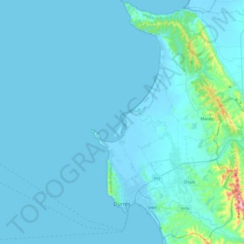
Name: Bashkia Durrës topographic map, elevation, terrain.
Location: Bashkia Durrës, Durrës County, Northern Albania, Albania (41.25890 19.39150 41.58799 19.62494)
Average elevation: 23 m
Minimum elevation: -5 m
Maximum elevation: 460 m
Other topographic maps
Click on a map to view its topography, its elevation and its terrain.
Krujë
Albania > Northern Albania > Durrës County > Kruje
Krujë is found at an altitude of 600 m (1,969 ft) on the foot of Mount Krujë (Albanian: Mali i Krujës), while south and west of the town is found the plain of the Ishëm River. The town is located in the northern part of the outer Albanides tectonic unit, which consists of anticlines of Mesozoic carbonate…
Average elevation: 397 m