
Thank you for supporting this site ❤️
Make a donation
Make a donation
Hatfield topographic map
Click on the map to display elevation.
Thank you for supporting this site ❤️
Make a donation
Make a donation
About this map
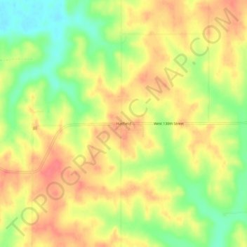
Name: Hatfield topographic map, elevation, terrain.
Location: Hatfield, Harrison County, Missouri, 64458, United States (40.50888 -94.17495 40.54888 -94.13495)
Average elevation: 338 m
Minimum elevation: 302 m
Maximum elevation: 364 m
Thank you for supporting this site ❤️
Make a donation
Make a donation
Other topographic maps
Click on a map to view its topography, its elevation and its terrain.