
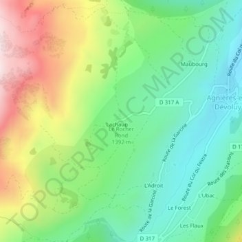
Le Rocher Rond topographic map
Interactive map
Click on the map to display elevation.
About this map
Name: Le Rocher Rond topographic map, elevation, terrain.
Average elevation: 1,447 m
Minimum elevation: 1,237 m
Maximum elevation: 1,816 m
Other topographic maps
Click on a map to view its topography, its elevation and its terrain.
Lachaup
France > Provence-Alpes-Côte d'Azur > Hautes-Alpes > Le Dévoluy > Lachaup
Lachaup, Agnières-en-Dévoluy, Le Dévoluy, Gap, Hautes-Alpes, Provence-Alpes-Côte d'Azur, France métropolitaine, 05250, France
Average elevation: 1,500 m