
Neu-Kupfer topographic map
Interactive map
Click on the map to display elevation.
About this map
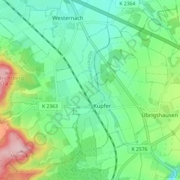
Name: Neu-Kupfer topographic map, elevation, terrain.
Average elevation: 384 m
Minimum elevation: 327 m
Maximum elevation: 520 m
Other topographic maps
Click on a map to view its topography, its elevation and its terrain.
Beltersrot
Deutschland > Baden-Württemberg > Hohenlohekreis > Kupferzell
Beltersrot, Kupferzell, Verwaltungsverband Hohenloher Ebene, Hohenlohekreis, Baden-Württemberg, 74635, Deutschland
Average elevation: 403 m
Kubach
Deutschland > Baden-Württemberg > Hohenlohekreis > Kupferzell
Kubach, Kupferzell, Verwaltungsverband Hohenloher Ebene, Hohenlohekreis, Baden-Württemberg, 74635, Deutschland
Average elevation: 368 m