
Thank you for supporting this site ❤️
Make a donation
Make a donation
Hudson Bay topographic map
Click on the map to display elevation.
Thank you for supporting this site ❤️
Make a donation
Make a donation
About this map
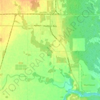
Name: Hudson Bay topographic map, elevation, terrain.
Location: Hudson Bay, Division No. 14, Saskatchewan, S0E 0Y0, Canada (52.81447 -102.40609 52.87127 -102.33347)
Average elevation: 370 m
Minimum elevation: 352 m
Maximum elevation: 386 m
Thank you for supporting this site ❤️
Make a donation
Make a donation