
Sagar topographic map
Click on the map to display elevation.
About this map
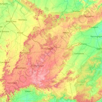
Name: Sagar topographic map, elevation, terrain.
Location: Sagar, Madhya Pradesh, India (23.16511 78.05841 24.45432 79.35273)
Average elevation: 450 m
Minimum elevation: 322 m
Maximum elevation: 688 m
Other topographic maps
Click on a map to view its topography, its elevation and its terrain.