
Thank you for supporting this site ❤️
Make a donation
Make a donation
Fleming topographic map
Click on the map to display elevation.
Thank you for supporting this site ❤️
Make a donation
Make a donation
About this map
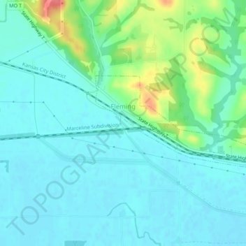
Name: Fleming topographic map, elevation, terrain.
Location: Fleming, Ray County, Missouri, United States (39.19070 -94.07014 39.20322 -94.02853)
Average elevation: 226 m
Minimum elevation: 211 m
Maximum elevation: 277 m
Thank you for supporting this site ❤️
Make a donation
Make a donation
Other topographic maps
Click on a map to view its topography, its elevation and its terrain.