
Thank you for supporting this site ❤️
Make a donation
Make a donation
Ganze topographic map
Click on the map to display elevation.
Thank you for supporting this site ❤️
Make a donation
Make a donation
About this map
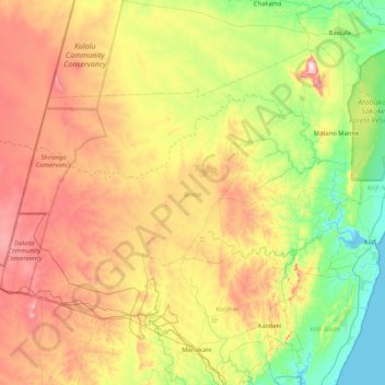
Name: Ganze topographic map, elevation, terrain.
Location: Ganze, Kilifi County, Coastal Kenya, Kenya (-3.84360 39.08790 -3.21048 39.92146)
Average elevation: 202 m
Minimum elevation: -1 m
Maximum elevation: 520 m
Thank you for supporting this site ❤️
Make a donation
Make a donation