
Parroquia Ipire topographic map
Interactive map
Click on the map to display elevation.
About this map
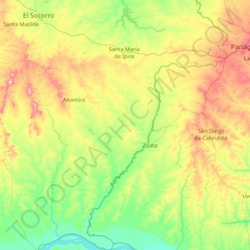
Name: Parroquia Ipire topographic map, elevation, terrain.
Location: Parroquia Ipire, Municipio Ipire, Estado Guárico, Venezuela (7.84855 -65.56582 9.07118 -64.80607)
Average elevation: 117 m
Minimum elevation: 15 m
Maximum elevation: 381 m
Other topographic maps
Click on a map to view its topography, its elevation and its terrain.
Las Brisas
Venezuela > Estado Guárico > Municipio Ipire
Las Brisas, Parroquia Ipire, Municipio Ipire, Estado Guárico, Venezuela
Average elevation: 121 m