
Lahuy Island topographic map
Interactive map
Click on the map to display elevation.
About this map
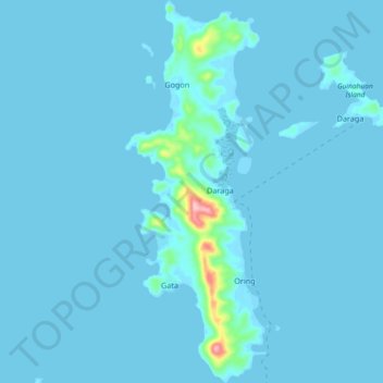
Name: Lahuy Island topographic map, elevation, terrain.
Average elevation: 7 m
Minimum elevation: -2 m
Maximum elevation: 173 m
Other topographic maps
Click on a map to view its topography, its elevation and its terrain.
Tawog
Philippines > Camarines Sur > Caramoan
Tawog, Caramoan, Camarines Sur, Bicol Region, 4429, Philippines
Average elevation: 60 m
Pagdawitan
Philippines > Camarines Sur > Caramoan > Mandiclum
Pagdawitan, Mandiclum, Caramoan, Camarines Sur, Bicol Region, Philippines
Average elevation: 58 m