
Thank you for supporting this site ❤️
Make a donation
Make a donation
Nagtipunan topographic map
Click on the map to display elevation.
Thank you for supporting this site ❤️
Make a donation
Make a donation
About this map
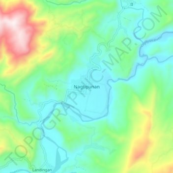
Name: Nagtipunan topographic map, elevation, terrain.
Location: Nagtipunan, Quirino, Cagayan Valley, Philippines (16.17778 121.56535 16.25778 121.64535)
Average elevation: 388 m
Minimum elevation: 159 m
Maximum elevation: 1,017 m
Thank you for supporting this site ❤️
Make a donation
Make a donation
Other topographic maps
Click on a map to view its topography, its elevation and its terrain.