
Bryon Dam topographic map
Interactive map
Click on the map to display elevation.
About this map
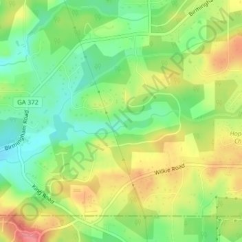
Name: Bryon Dam topographic map, elevation, terrain.
Average elevation: 342 m
Minimum elevation: 303 m
Maximum elevation: 389 m
Other topographic maps
Click on a map to view its topography, its elevation and its terrain.
Peachtree City
United States of America > Georgia > Peachtree City
Peachtree City, Fayette, Georgia, United States of America
Average elevation: 263 m
Augusta
United States of America > Georgia > Augusta
Augusta, Richmond County, Georgia, 30901, United States of America
Average elevation: 90 m