
Mykines topographic map
Interactive map
Click on the map to display elevation.
About this map
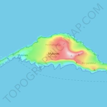
Name: Mykines topographic map, elevation, terrain.
Location: Mykines, Vágar region, 388, Faroe Islands (62.09197 -7.66510 62.11701 -7.52789)
Average elevation: 43 m
Minimum elevation: -38 m
Maximum elevation: 564 m