
Thank you for supporting this site ❤️
Make a donation
Make a donation
Udall topographic map
Click on the map to display elevation.
Thank you for supporting this site ❤️
Make a donation
Make a donation
About this map
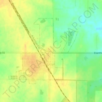
Name: Udall topographic map, elevation, terrain.
Location: Udall, Cowley County, Kansas, United States (37.38237 -97.12831 37.39965 -97.10527)
Average elevation: 384 m
Minimum elevation: 367 m
Maximum elevation: 396 m
Thank you for supporting this site ❤️
Make a donation
Make a donation
Other topographic maps
Click on a map to view its topography, its elevation and its terrain.
Arkansas City
United States > Kansas > Cowley County > Arkansas City > Arkansas City
Average elevation: 339 m