
Wuxi topographic map
Interactive map
Click on the map to display elevation.
About this map
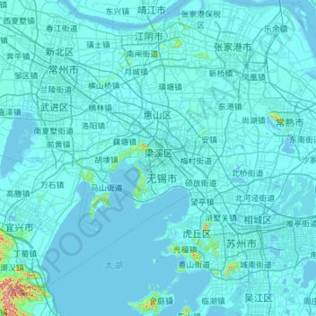
Name: Wuxi topographic map, elevation, terrain.
Location: Wuxi, Jiangsu, 214000, China (31.10415 119.51448 31.99271 120.60051)
Average elevation: 9 m
Minimum elevation: -5 m
Maximum elevation: 489 m
Other topographic maps
Click on a map to view its topography, its elevation and its terrain.