
Thank you for supporting this site ❤️
Make a donation
Make a donation
Ngea topographic map
Click on the map to display elevation.
Thank you for supporting this site ❤️
Make a donation
Make a donation
About this map
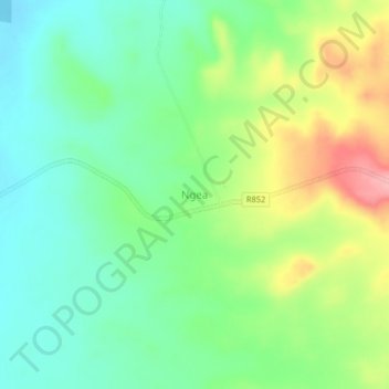
Name: Ngea topographic map, elevation, terrain.
Location: Ngea, Kilwa, Lindi Region, Coastal Zone, Tanzania (-8.87911 38.99185 -8.83911 39.03185)
Average elevation: 97 m
Minimum elevation: 53 m
Maximum elevation: 179 m
Thank you for supporting this site ❤️
Make a donation
Make a donation
Other topographic maps
Click on a map to view its topography, its elevation and its terrain.