
Thank you for supporting this site ❤️
Make a donation
Make a donation
Cerro Argolla topographic map
Click on the map to display elevation.
Thank you for supporting this site ❤️
Make a donation
Make a donation
About this map
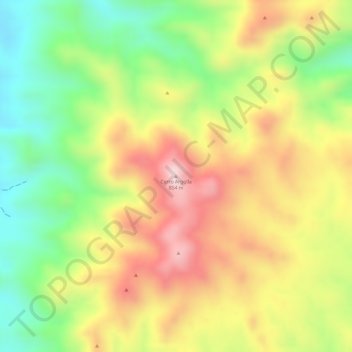
Name: Cerro Argolla topographic map, elevation, terrain.
Average elevation: 691 m
Minimum elevation: 524 m
Maximum elevation: 850 m
Thank you for supporting this site ❤️
Make a donation
Make a donation
Other topographic maps
Click on a map to view its topography, its elevation and its terrain.
Quebrada de La Plata
Chile > Región de Antofagasta > Provincia de Antofagasta > Taltal
Average elevation: 77 m