
Thank you for supporting this site ❤️
Make a donation
Make a donation
Carasi topographic map
Click on the map to display elevation.
Thank you for supporting this site ❤️
Make a donation
Make a donation
About this map
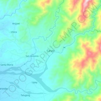
Name: Carasi topographic map, elevation, terrain.
Location: Carasi, Ilocos Norte, Ilocos Region, 2910, Philippines (18.10145 120.78176 18.18145 120.86176)
Average elevation: 216 m
Minimum elevation: 55 m
Maximum elevation: 804 m
Thank you for supporting this site ❤️
Make a donation
Make a donation
Other topographic maps
Click on a map to view its topography, its elevation and its terrain.