
Thank you for supporting this site ❤️
Make a donation
Make a donation
Scarbro topographic map
Click on the map to display elevation.
Thank you for supporting this site ❤️
Make a donation
Make a donation
About this map
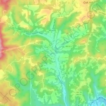
Name: Scarbro topographic map, elevation, terrain.
Location: Scarbro, Fayette County, West Virginia, 25917, United States (37.93317 -81.18566 37.97317 -81.14566)
Average elevation: 567 m
Minimum elevation: 477 m
Maximum elevation: 689 m
Thank you for supporting this site ❤️
Make a donation
Make a donation
Other topographic maps
Click on a map to view its topography, its elevation and its terrain.