
Thank you for supporting this site ❤️
Make a donation
Make a donation
Ban Huai Pod topographic map
Click on the map to display elevation.
Thank you for supporting this site ❤️
Make a donation
Make a donation
About this map
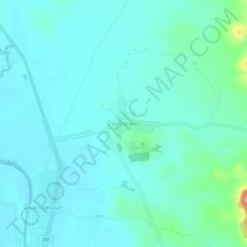
Name: Ban Huai Pod topographic map, elevation, terrain.
Location: Ban Huai Pod, That, Loei Province, Thailand (17.71016 101.70845 17.75016 101.74845)
Average elevation: 246 m
Minimum elevation: 223 m
Maximum elevation: 377 m
Thank you for supporting this site ❤️
Make a donation
Make a donation