
Thank you for supporting this site ❤️
Make a donation
Make a donation
Talipao topographic map
Click on the map to display elevation.
Thank you for supporting this site ❤️
Make a donation
Make a donation
About this map
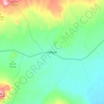
Name: Talipao topographic map, elevation, terrain.
Location: Talipao, Sulu, Bangsamoro, Philippines (5.93623 121.07461 6.01623 121.15461)
Average elevation: 138 m
Minimum elevation: 10 m
Maximum elevation: 477 m
Thank you for supporting this site ❤️
Make a donation
Make a donation
Other topographic maps
Click on a map to view its topography, its elevation and its terrain.