
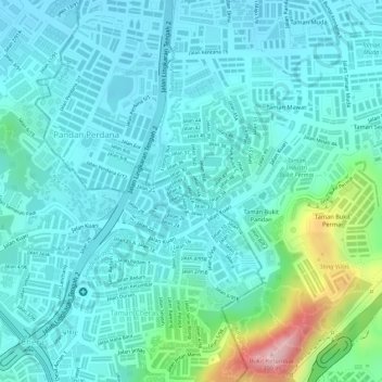
Kampung Cheras Baru topographic map
Interactive map
Click on the map to display elevation.
About this map
Name: Kampung Cheras Baru topographic map, elevation, terrain.
Average elevation: 99 m
Minimum elevation: 50 m
Maximum elevation: 306 m
Other topographic maps
Click on a map to view its topography, its elevation and its terrain.
Perwira Jaya
Malaysia > Selangor > Ampang Jaya Municipal Council
Perwira Jaya, Ampang, Ampang Jaya Municipal Council, Hulu Langat, Selangor, 50600, Malaysia
Average elevation: 51 m
Kampung Sri Taman Baru
Malaysia > Selangor > Ampang Jaya Municipal Council
Kampung Sri Taman Baru, Ampang, Ampang Jaya Municipal Council, Hulu Langat, Selangor, 55300, Malaysia
Average elevation: 109 m
Kampung Dato Mufti Shuib
Malaysia > Selangor > Ampang Jaya Municipal Council
Kampung Dato Mufti Shuib, Ampang, Ampang Jaya Municipal Council, Hulu Langat, Selangor, 68000, Malaysia
Average elevation: 118 m
Ampang River
Malaysia > Selangor > Ampang Jaya Municipal Council > Kampung Muhibbah
Ampang River, Kampung Muhibbah, Ampang, Ampang Jaya Municipal Council, Hulu Langat, Selangor, Malaysia
Average elevation: 71 m
Air Terjun Empangan Tasik Hijau
Malaysia > Selangor > Ampang Jaya Municipal Council
Air Terjun Empangan Tasik Hijau, Ulu Kelang, Ampang Jaya Municipal Council, Gombak, Selangor, 68000, Malaysia
Average elevation: 184 m
Taman Bukit Indah
Malaysia > Selangor > Ampang Jaya Municipal Council
Taman Bukit Indah, The Valley TTDI, Ampang Jaya Municipal Council, Gombak, Selangor, Malaysia
Average elevation: 104 m
Sungai Sering
Malaysia > Selangor > Ampang Jaya Municipal Council
Sungai Sering, Taman Ukay Bistari, Bukit Antarabangsa, Ulu Kelang, Ampang Jaya Municipal Council, Gombak, Selangor, 54200, Malaysia
Average elevation: 100 m
Sungai Kerayong
Malaysia > Selangor > Ampang Jaya Municipal Council
Sungai Kerayong, Ampang Jaya Municipal Council, Hulu Langat, Selangor, 51500, Malaysia
Average elevation: 67 m
Kampung Muhibbah
Malaysia > Selangor > Ampang Jaya Municipal Council
Kampung Muhibbah, Ampang, Ampang Jaya Municipal Council, Hulu Langat, Selangor, 68000, Malaysia
Average elevation: 129 m
Kawasan Rekreasi AU2 Keramat
Malaysia > Selangor > Ampang Jaya Municipal Council
Kawasan Rekreasi AU2 Keramat, AU2, Ulu Kelang, Ampang Jaya Municipal Council, Gombak, Selangor, Malaysia
Average elevation: 74 m
Klang Gates Dam
Malaysia > Selangor > Ampang Jaya Municipal Council
Klang Gates Dam, Ulu Kelang, Ampang Jaya Municipal Council, Gombak, Selangor, Malaysia
Average elevation: 148 m
Kampung Indah Permai
Malaysia > Selangor > Ampang Jaya Municipal Council
Kampung Indah Permai, Ampang, Ampang Jaya Municipal Council, Hulu Langat, Selangor, 68000, Malaysia
Average elevation: 137 m
Kampung Tasik Tambahan
Malaysia > Selangor > Ampang Jaya Municipal Council
Kampung Tasik Tambahan, Ampang, Ampang Jaya Municipal Council, Hulu Langat, Selangor, 68000, Malaysia
Average elevation: 118 m
Kampung Tasek Permai
Malaysia > Selangor > Ampang Jaya Municipal Council
Kampung Tasek Permai, Ampang, Ampang Jaya Municipal Council, Hulu Langat, Selangor, 43100, Malaysia
Average elevation: 154 m