
Thank you for supporting this site ❤️
Make a donation
Make a donation
Richland County topographic map
Click on the map to display elevation.
Thank you for supporting this site ❤️
Make a donation
Make a donation
About this map
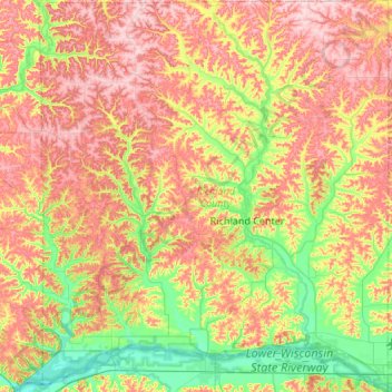
Name: Richland County topographic map, elevation, terrain.
Location: Richland County, Wisconsin, United States (43.16404 -90.67163 43.55496 -90.19163)
Average elevation: 290 m
Minimum elevation: 194 m
Maximum elevation: 398 m
Thank you for supporting this site ❤️
Make a donation
Make a donation
Other topographic maps
Click on a map to view its topography, its elevation and its terrain.