
Thank you for supporting this site ❤️
Make a donation
Make a donation
Trendelburg topographic map
Click on the map to display elevation.
Thank you for supporting this site ❤️
Make a donation
Make a donation
About this map
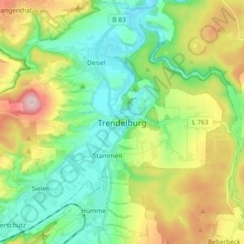
Name: Trendelburg topographic map, elevation, terrain.
Location: Trendelburg, Landkreis Kassel, Hesse, 34388, Germany (51.53354 9.38242 51.61354 9.46242)
Average elevation: 199 m
Minimum elevation: 107 m
Maximum elevation: 383 m
Thank you for supporting this site ❤️
Make a donation
Make a donation
Other topographic maps
Click on a map to view its topography, its elevation and its terrain.
Thank you for supporting this site ❤️
Make a donation
Make a donation
Thank you for supporting this site ❤️
Make a donation
Make a donation
Thank you for supporting this site ❤️
Make a donation
Make a donation