
Thank you for supporting this site ❤️
Make a donation
Make a donation
Mantaro topographic map
Click on the map to display elevation.
Thank you for supporting this site ❤️
Make a donation
Make a donation
About this map
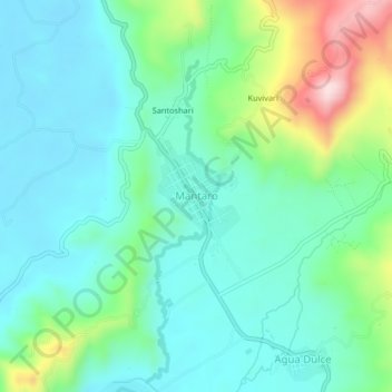
Name: Mantaro topographic map, elevation, terrain.
Location: Mantaro, Pichari, La Convención, Cusco, Perú (-12.34354 -73.96052 -12.30354 -73.92052)
Average elevation: 557 m
Minimum elevation: 476 m
Maximum elevation: 808 m
Thank you for supporting this site ❤️
Make a donation
Make a donation