Geolocate

Newton County topographic map

Interactive map

Click on the map to display elevation.

About this map

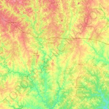
Name: Newton County topographic map, elevation, terrain.

Location: Newton County, Georgia, United States (33.36724 -84.05522 33.74420 -83.67464)

Average elevation: 217 m

Minimum elevation: 139 m

Maximum elevation: 316 m

Other topographic maps

Click on a map to view its topography, its elevation and its terrain.

Lake Royal

United States > Georgia > Columbia County

Average elevation: 122 m

Denmark

United States > Georgia > Bulloch County

Average elevation: 45 m

Waverly

United States > Georgia > Richmond County > Augusta

Average elevation: 96 m

Westwood

United States > Georgia > Richmond County > Augusta

Average elevation: 105 m

Brighton

United States > Georgia > Brighton

Average elevation: 109 m

McKinney

United States > Georgia > Upson County > McKinney

Average elevation: 224 m

Duluth

United States > Georgia > Duluth

Average elevation: 304 m