
Thank you for supporting this site ❤️
Make a donation
Make a donation
Chefchaouen topographic map
Click on the map to display elevation.
Thank you for supporting this site ❤️
Make a donation
Make a donation
Chefchaouen
The province of Chefchaouen has a Mediterranean climate characterized by rainy and cool winters from October to April, and dry and hot summers from May to September. The average annual rainfall is around 880 mm (35 in), variable with altitude and proximity to the coast. (Rainfall could reach 1,400–2,000 mm per year, with snowfall over the mountains peaks.) Likewise, the temperature remains influenced by the Mediterranean Sea, altitude and winds, with the mean annual temperature around 16.6 °C (61.9 °F).
Thank you for supporting this site ❤️
Make a donation
Make a donation
About this map
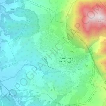
Name: Chefchaouen topographic map, elevation, terrain.
Average elevation: 619 m
Minimum elevation: 279 m
Maximum elevation: 1,600 m
Thank you for supporting this site ❤️
Make a donation
Make a donation