
Morris County topographic map
Interactive map
Click on the map to display elevation.
About this map
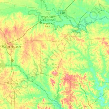
Name: Morris County topographic map, elevation, terrain.
Location: Morris County, Texas, United States of America (32.87927 -94.81739 33.36387 -94.65206)
Average elevation: 102 m
Minimum elevation: 61 m
Maximum elevation: 184 m
Other topographic maps
Click on a map to view its topography, its elevation and its terrain.
Lake Medina Highlands
United States of America > Texas > Lakehills > Lake Medina Highlands
Average elevation: 344 m