
Amberley topographic map
Click on the map to display elevation.
About this map
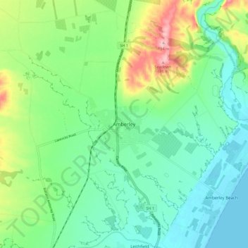
Name: Amberley topographic map, elevation, terrain.
Location: Amberley, Hurunui District, Canterbury, 7441, New Zealand (-43.19130 172.69299 -43.11130 172.77299)
Average elevation: 55 m
Minimum elevation: 0 m
Maximum elevation: 189 m
Hurunui District trails, hiking, mountain biking, running and outdoor activities