
Bilthoven topographic map
Interactive map
Click on the map to display elevation.
About this map
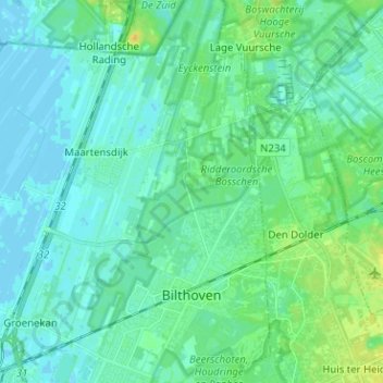
Name: Bilthoven topographic map, elevation, terrain.
Location: Bilthoven, De Bilt, Utrecht, Netherlands (52.11117 5.17372 52.18875 5.23023)
Average elevation: 5 m
Minimum elevation: -3 m
Maximum elevation: 19 m