
Zorneding topographic map
Interactive map
Click on the map to display elevation.
About this map
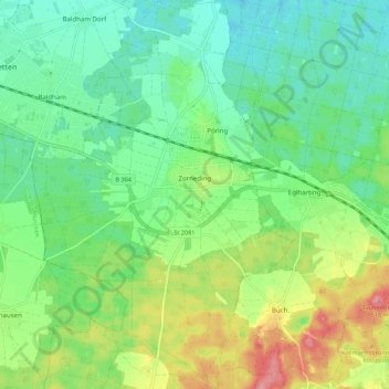
Name: Zorneding topographic map, elevation, terrain.
Location: Zorneding, Landkreis Ebersberg, Bavaria, 85604, Germany (48.04501 11.78180 48.11839 11.85523)
Average elevation: 562 m
Minimum elevation: 527 m
Maximum elevation: 631 m