
Make a donation
Appalachian Mountains topographic map
Click on the map to display elevation.
Make a donation
Appalachian Mountains
The range is older than the other major mountain range in North America, the Rocky Mountains of the west. Some of the outcrops in the Appalachians contain rocks formed during the Precambrian era. The geologic processes that led to the formation of the Appalachian Mountains started 1.1 billion years ago. The first mountain range in the region was created when the continents of Laurentia and Amazonia collided, creating a supercontinent called Rodinia. The collision of these continents caused the rocks to be folded and faulted, creating the first mountains in the region. Many of the rocks and minerals that were formed during that event can currently be seen at the surface of the present Appalachian range. Around 480 million years ago, geologic processes began that led to three distinct orogenic eras that created much of the surface structure seen in today's Appalachians. During this period, mountains once reached elevations similar to those of the Alps and the Rockies before natural erosion occurred over the last 240 million years leading to what is present today.
Make a donation
About this map
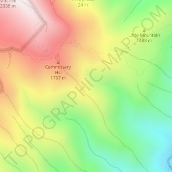
Name: Appalachian Mountains topographic map, elevation, terrain.
Average elevation: 1,463 m
Minimum elevation: 962 m
Maximum elevation: 2,002 m
Make a donation
Other topographic maps
Click on a map to view its topography, its elevation and its terrain.
Mount Mitchell State Park
United States > North Carolina > Yancey County > Burnsville
In addition to Mount Mitchell itself, the park encompasses several other peaks which top out at over 6,000 feet (1,800 m) in elevation, including Mount Hallback, Mount Craig (just 52 feet (16 m) shy of Mount Mitchell in elevation and the second highest peak east of the Mississippi River), Big Tom and Balsam…
Average elevation: 1,271 m
Make a donation