
la Pobla de Farnals topographic map
Interactive map
Click on the map to display elevation.
About this map
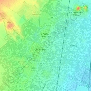
Name: la Pobla de Farnals topographic map, elevation, terrain.
Average elevation: 15 m
Minimum elevation: -1 m
Maximum elevation: 45 m
Other topographic maps
Click on a map to view its topography, its elevation and its terrain.
Penyagolosa
Spain > Valencian Community > Castelló / Castellón > Xodos / Chodos
Average elevation: 1,417 m