
San Juan topographic map
Interactive map
Click on the map to display elevation.
About this map
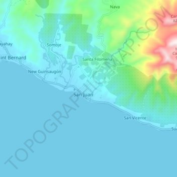
Name: San Juan topographic map, elevation, terrain.
Location: San Juan, Southern Leyte, Eastern Visayas, 6611, Philippines (10.22290 125.13290 10.30290 125.21290)
Average elevation: 95 m
Minimum elevation: 0 m
Maximum elevation: 849 m
Other topographic maps
Click on a map to view its topography, its elevation and its terrain.