
Kisangani topographic map
Interactive map
Click on the map to display elevation.
About this map
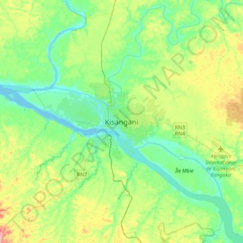
Name: Kisangani topographic map, elevation, terrain.
Location: Kisangani, Tshopo, Democratic Republic of the Congo (0.35840 25.04573 0.67840 25.36573)
Average elevation: 415 m
Minimum elevation: 378 m
Maximum elevation: 503 m