
Villamaría topographic map
Interactive map
Click on the map to display elevation.
About this map
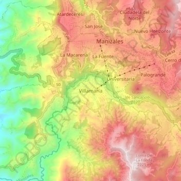
Name: Villamaría topographic map, elevation, terrain.
Location: Villamaría, Centrosur, Caldas, 176001, Colombia (5.00497 -75.55513 5.08497 -75.47513)
Average elevation: 1,947 m
Minimum elevation: 1,401 m
Maximum elevation: 2,420 m