
Thank you for supporting this site ❤️
Make a donation
Make a donation
Sugar Loaf topographic map
Click on the map to display elevation.
Thank you for supporting this site ❤️
Make a donation
Make a donation
About this map
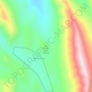
Name: Sugar Loaf topographic map, elevation, terrain.
Location: Sugar Loaf, Lewis and Clark County, Montana, United States (47.51795 -112.72703 47.51805 -112.72693)
Average elevation: 1,881 m
Minimum elevation: 1,639 m
Maximum elevation: 2,264 m
Thank you for supporting this site ❤️
Make a donation
Make a donation
Other topographic maps
Click on a map to view its topography, its elevation and its terrain.