
Thank you for supporting this site ❤️
Make a donation
Make a donation
Endexhe topographic map
Click on the map to display elevation.
Thank you for supporting this site ❤️
Make a donation
Make a donation
About this map
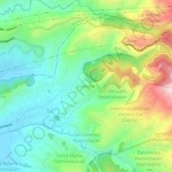
Name: Endexhe topographic map, elevation, terrain.
Location: Endexhe, Lerma, State of Mexico, 52050, Mexico (19.38885 -99.48624 19.42885 -99.44624)
Average elevation: 2,740 m
Minimum elevation: 2,583 m
Maximum elevation: 3,054 m
Thank you for supporting this site ❤️
Make a donation
Make a donation