
Thank you for supporting this site ❤️
Make a donation
Make a donation
Lexington topographic map
Click on the map to display elevation.
Thank you for supporting this site ❤️
Make a donation
Make a donation
About this map
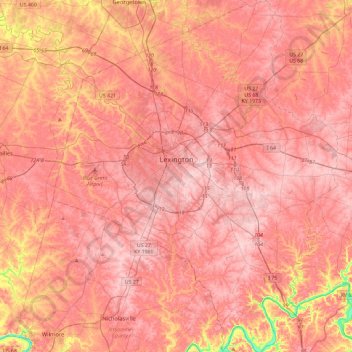
Name: Lexington topographic map, elevation, terrain.
Location: Lexington, Fayette County, Kentucky, United States (37.84530 -84.66014 38.21140 -84.28272)
Average elevation: 281 m
Minimum elevation: 161 m
Maximum elevation: 326 m
Thank you for supporting this site ❤️
Make a donation
Make a donation
Other topographic maps
Click on a map to view its topography, its elevation and its terrain.
Thank you for supporting this site ❤️
Make a donation
Make a donation
Appalachian Plateau Region
United States > Kentucky > Fayette County > Lexington
Average elevation: 309 m
Thank you for supporting this site ❤️
Make a donation
Make a donation
University of Kentucky Arboretum
United States > Kentucky > Fayette County > Lexington
Average elevation: 309 m
Thank you for supporting this site ❤️
Make a donation
Make a donation