
Westerville topographic map
Interactive map
Click on the map to display elevation.
About this map
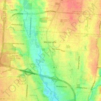
Name: Westerville topographic map, elevation, terrain.
Location: Westerville, Franklin County, Ohio, 43081, USA (40.08898 -82.97158 40.15158 -82.88042)
Average elevation: 267 m
Minimum elevation: 239 m
Maximum elevation: 289 m