
Општина Бечеј topographic map
Interactive map
Click on the map to display elevation.
About this map
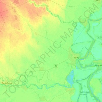
Name: Општина Бечеј topographic map, elevation, terrain.
Location: Општина Бечеј, Јужнобачки управни округ, Voïvodine, Serbie (45.49934 19.76706 45.76398 20.13383)
Average elevation: 82 m
Minimum elevation: 69 m
Maximum elevation: 102 m