
Thank you for supporting this site ❤️
Make a donation
Make a donation
Lamalonga topographic map
Click on the map to display elevation.
Thank you for supporting this site ❤️
Make a donation
Make a donation
About this map
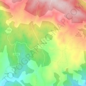
Name: Lamalonga topographic map, elevation, terrain.
Location: Lamalonga, La Vega, Valdeorras, Orense, Galicia, 32366, España (42.25932 -6.98467 42.29932 -6.94467)
Average elevation: 1,205 m
Minimum elevation: 992 m
Maximum elevation: 1,412 m
Thank you for supporting this site ❤️
Make a donation
Make a donation
Other topographic maps
Click on a map to view its topography, its elevation and its terrain.
Prada
España > Galicia > Valdeorras > La Vega
Al sur, el embalse (altitud media 861 m y bajo sus aguas la antigua parroquia y lugar de Alberguería que estaba a 817 m) y a 11 km por carretera, la capital del municipio, La Vega.
Average elevation: 1,075 m
Thank you for supporting this site ❤️
Make a donation
Make a donation