
Thank you for supporting this site ❤️
Make a donation
Make a donation
Brown County topographic map
Click on the map to display elevation.
Thank you for supporting this site ❤️
Make a donation
Make a donation
About this map
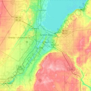
Name: Brown County topographic map, elevation, terrain.
Location: Brown County, Wisconsin, United States (44.24015 -88.25256 44.67986 -87.76184)
Average elevation: 226 m
Minimum elevation: 174 m
Maximum elevation: 306 m
Thank you for supporting this site ❤️
Make a donation
Make a donation
Other topographic maps
Click on a map to view its topography, its elevation and its terrain.