
Fayette County topographic map
Interactive map
Click on the map to display elevation.
About this map
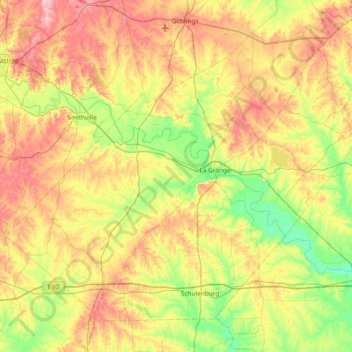
Name: Fayette County topographic map, elevation, terrain.
Location: Fayette County, Texas, United States of America (29.62804 -97.31785 30.16454 -96.56932)
Average elevation: 117 m
Minimum elevation: 55 m
Maximum elevation: 202 m
Other topographic maps
Click on a map to view its topography, its elevation and its terrain.
Lake Medina Highlands
United States of America > Texas > Lakehills > Lake Medina Highlands
Average elevation: 344 m