
Palangka Raya topographic map
Interactive map
Click on the map to display elevation.
Palangka Raya
Palangka Raya borders Gunung Mas Regency to the north, Katingan Regency to the west, and Pulang Pisau Regency to the south and east. The area's soil consists mostly of peat and alluvium in its southern part and podzol on the northern part of the city. Overall, podzol soil dominates the city soil with 218,486 out of 285,349 hectares of city's landscape. Most of the city's topography is flat, with a general slope of less than 40 percent. Palangka Raya is mostly located around 35 meters above sea level.
About this map
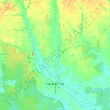
Name: Palangka Raya topographic map, elevation, terrain.
Location: Palangka Raya, Central Kalimantan, Kalimantan, Indonesia (-2.40362 113.47569 -1.58472 114.10829)
Average elevation: 23 m
Minimum elevation: -1 m
Maximum elevation: 114 m