
Thank you for supporting this site ❤️
Make a donation
Make a donation
Karagwe topographic map
Click on the map to display elevation.
Thank you for supporting this site ❤️
Make a donation
Make a donation
About this map
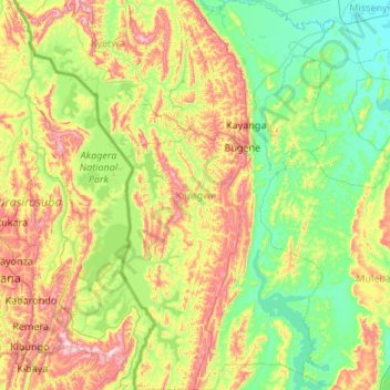
Name: Karagwe topographic map, elevation, terrain.
Location: Karagwe, Kagera, Lake Zone, Tanzania (-2.26065 30.80783 -1.18725 31.39287)
Average elevation: 1,354 m
Minimum elevation: 1,142 m
Maximum elevation: 1,902 m
Thank you for supporting this site ❤️
Make a donation
Make a donation