
Xhariep District Municipality topographic map
Interactive map
Click on the map to display elevation.
About this map
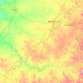
Name: Xhariep District Municipality topographic map, elevation, terrain.
Location: Xhariep District Municipality, Free State, South Africa (-30.69408 24.34662 -28.82826 27.41033)
Average elevation: 1,371 m
Minimum elevation: 1,010 m
Maximum elevation: 2,371 m
Other topographic maps
Click on a map to view its topography, its elevation and its terrain.
Metsimaholo Local Municipality
South Africa > Free State > Fezile Dabi District Municipality
Metsimaholo Local Municipality, Fezile Dabi District Municipality, Free State, 1947, South Africa
Average elevation: 1,497 m
Vredefort
South Africa > Free State > Vredefort
Vredefort, Fezile Dabi District Municipality, Free State, 9595, South Africa
Average elevation: 1,430 m