
Thank you for supporting this site ❤️
Make a donation
Make a donation
La Loma topographic map
Click on the map to display elevation.
Thank you for supporting this site ❤️
Make a donation
Make a donation
About this map
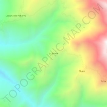
Name: La Loma topographic map, elevation, terrain.
Location: La Loma, Huarmaca, Huancabamba, Piura, Perú (-5.63182 -79.63060 -5.59182 -79.59060)
Average elevation: 1,253 m
Minimum elevation: 710 m
Maximum elevation: 2,082 m
Thank you for supporting this site ❤️
Make a donation
Make a donation