
Ootake topographic map
Interactive map
Click on the map to display elevation.
About this map
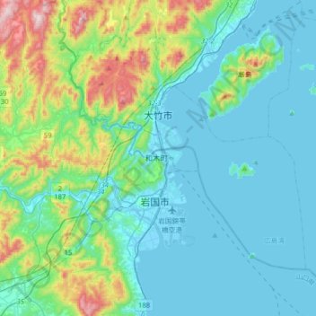
Name: Ootake topographic map, elevation, terrain.
Location: Ootake, Hiroshima Prefecture, Chugoku Region, Japan (34.07159 132.12398 34.33171 132.36952)
Average elevation: 134 m
Minimum elevation: -3 m
Maximum elevation: 715 m
Other topographic maps
Click on a map to view its topography, its elevation and its terrain.
Chugoku Region
Tottori Prefecture, Chugoku Region, Japan
Average elevation: 239 m