
डोल्पा topographic map
Interactive map
Click on the map to display elevation.
About this map
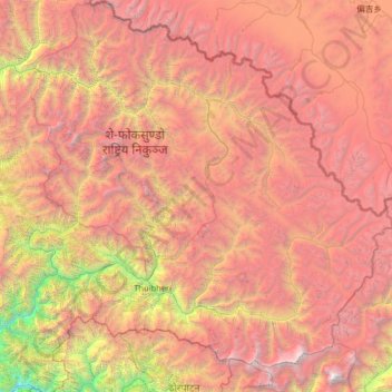
Name: डोल्पा topographic map, elevation, terrain.
Location: डोल्पा, Karnali, Népal (28.72190 82.39256 29.70741 83.67995)
Average elevation: 4,555 m
Minimum elevation: 972 m
Maximum elevation: 8,065 m
Le district de Dolpa (en népalais. डोल्पा जिल्ला) est l'un des 75 districts du Népal. Il est rattaché à la zone de Karnali et à la région de développement Moyen-Ouest. La population du district s'élevait à 36 700 habitants en 2011. Sa capitale administrative est Dunai, située à 2 150 mètres d'altitude.
Other topographic maps
Click on a map to view its topography, its elevation and its terrain.
Shey Phoksundo
Shey Phoksundo, डोल्पा, Karnali, Népal
Average elevation: 4,792 m
Chharka Tangsong-03
Chharka Tangsong-03, Chharka Tangsong, डोल्पा, Karnali, Népal
Average elevation: 4,795 m